"Fires and cities: the resilience of the wildland-urban interface to wildfires in the context of climate change"
Earth
Society
|
In France, 70% of wildfires start in the wildland-urban interface (WUI), which is to say the interface between cities and natural spaces1. While the vast majority of fires are of human origin and develop near dwellings, climate change and the increased risks associated with it raise questions regarding the resilience capacity of cities. With these issues in mind, the CNRS invites you to discover the results of its collective scientific expert review, which mobilised a multidisciplinary group of 17 scientists. Based on over 1,100 scientific publications, it provides an overview of scientific knowledge on fire risk and its impact on the wildland-urban interface. This expert review also offers a panorama of the existing knowledge on adaptation strategies, with a view to strengthening urban resilience to this growing risk.2
In 2022, the fires in the Gironde, which burned over 20,000 hectares, led to the evacuation of 36,000 people from such WUIs3. While 97% of fires in Europe are of anthropic origin and begin near dwellings, climate change and the increased risks associated with it raise questions regarding urban resilience capacity.
Multiple observations regarding wildfire risks for WUIs
In light of continued urbanization in high-risk WUIs and a new geography for fires, the scientific literature has reflected on the resources needed to enhance coordination among actors and adopt a sustainable approach, including protection for cities and management of surrounding natural spaces.
WUIs, which are expanding rapidly in France as elsewhere, concentrate both fire ignition sources4 and factors of vulnerability, notably by combining vegetation of varying density as well as exposed people and property. The demarcation and mapping of WUIs is key to managing risk, but remains a complex undertaking due to their many types–a majority of zones in Europe include both buildings and vegetation.
Moving beyond WUIs, numerous factors contribute to fire risk5 and “extreme” events. Fire risk is closely connected to population density, urban and suburban activities, and infrastructure, notably in connection with roads, rail, and electric power. Slightly different initial or local conditions can impact whether a fire outbreak is quickly extinguished, or instead becomes a major event. The forest fire weather index and forest weather are used in France as a solid basis for operations, and can be supplemented with other approaches using the probability of occurrence. Determining a fire’s propensity to become extreme is a key issue, with the methods for doing so continuing to evolve.
These observations also include studying the environmental, social, and economic consequences of fires. While the vulnerability of structures located in WUIs is well documented in the scientific literature, the same is not true for infrastructure, activity zones, and tourism. The criteria for assessment impact what vulnerable zones are taken into account, as well as whether priority is given to people, infrastructure, economic issues, environmental considerations, etc. Social dimensions are often underrepresented. Nevertheless, the impact of fires proportionally has a larger effect on more disadvantaged and fragile populations.
Intense or repeated fires can also degrade the soil and ecosystems, as well as homogenise landscapes, thereby increasing the risk of future fires. With respect to human losses, studies show that civilian victims most often die in vulnerable dwellings, or during late evacuations. In addition, cascade effects–which are enduring and revelatory of interdependence — extend beyond the area subject to fire. The literature tends to emphasize that the human and social impacts greatly amplify inequality. In OECD member countries, average annual economic losses connected to wildfires increased by 360% between 2000-2014 and 2015-2024. Finally, research shows that public spending on fire management and reconstruction implicitly subsidises urbanisation in high-risk areas by reducing individual incentives to avoid them.
Multiple approaches show that anthropic climate change has already greatly increased the probability of major fires. The forecasts of the forest fire weather index6 indicate that extreme fires will be more frequent—including in northern France, which had previously been little affected—with fire seasons lasting longer. Given these conditions of a new European geography for fires, an increase in extreme fires and strong territorial dynamics connected to WUIs call into question the capacity of current measures for protecting populations and property in the decades to come.
The resilience capacity of cities
The literature also presents a range of solutions for reducing risk before a fire, in addition to various curbs. Technical prevention measures firstly involve managing fuels to limit the fire’s spread, via expanded obligations to clear brushwood. It is also crucial to promote more resistant species in gardens and public spaces rather than conifers and eucalyptus. The effectiveness of these measures depends on coherent implementation from the plot level up to the territory, along with its maintenance over time. A second lever is strengthening buildings via resistant materials for exteriors and roofing, protection for openings, and distancing artificial fuels by spacing out garages and other outbuildings. Prevention plans exist at various territorial scales, and are connected to different types of actions. In France, Forest Fire Risk Prevention Plans, which impose regulations for urbanisation and building safety, are not widely implemented due to their cost, technical constraints, and strong opposition from local elected officials and populations. In the United States and Canada, local initiative plans—federally funded and led by public agencies—have been implemented at various scales, from the county down to ownership groups. Concrete aid for property owners, both financial and material, has proven the most effective.
The literature shows that social cohesion and a sense of community belonging facilitate resource sharing and strengthen the will to act. Studies demonstrate a need to understand that measures for securing WUIs over the long-term include both individual and collective engagement. It is essential to promote educational and participatory approaches, and not simply be content with diffusion or awareness campaigns. Finally, economic analyses show that an effective insurance coverage system against fires combines private insurance and public intervention by governments acting as the insurer of last resort. Ultimately, the effectiveness of prevention calls for a combination of different technical, economic, and social actions, as well as their joint implementation on different scales.
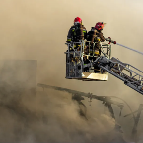
Regarding crisis management7, the scientific literature proposes various models for simulating fire spread, with a view to clarifying uncertainties and promoting scenario-based reasoning. For instance, recent research has coupled wildfire modelling and traffic simulation in order to better manage the thresholds at which the population is evacuated. Finally, extreme fires engender a change in fire regime, in which efforts at extinction reach their limits. When the fire interacts extensively with the atmosphere, its combination with other phenomena requires suitable and complex anticipation tools. In France, studies indicate that when conditions allow for it—especially for extreme fires—early and prepared evacuation represents the safest strategy for protecting human life. The ability to detect precursors and individual preparation for such extreme scenarios become central to ensuring the safety of populations. These tools and indices for extreme events remain poorly integrated within ordinary crisis management systems in France.
In order to rethink the governance of cities, the expert review concludes that town and country planning can help reduce impacts and optimise rescue efforts by adapting standards for construction and location. However, their implementation varies from country to country, ranging from strict standards in Australia to less restrictive recommendations in Chile, with France somewhere in between.
The scientific literature emphasizes that town and country planning remains an underexploited lever for action, with the general observation that urbanisation is continuing in high-risk areas. In the face of extreme fires, it also stresses the importance of a systemic approach combining risk management, planning, and the fight against climate change. These solutions are not intended to replace the current doctrine, but rather to complement it with approaches tailored to local contexts. They also presuppose that there are reflections underway on multiple scales, for protecting urban areas requires coordination with the management of surrounding areas.
To garner political backing, decision makers as well as construction and planning professionals should receive training in their shared responsibility with the population. This responsibility should also be differentiated, with a view to living with fire risk, and adapting to a logic of learning and experimentation.
To access the summary online, click here
Notes:
This interface refers to places where the city and wildland meet or mix.
The results of this expert review are not all at the same level of consolidation, with some conclusions being based on literature that is often from foreign contexts, and that is more fragmentary for France.
Wildland-urban interfaces are primarily used for housing, and result from the dual processes of urban sprawl and agricultural abandonment. They also include areas in which infrastructure is intertwined with agricultural plots, vegetation clusters, scattered housing, and abandoned land.
An ignition source refers to an intense heat source (lightning, BBQ, etc.) that can spark local combustion.
Fire risk includes hazard (probability of occurrence of an unwanted fire) and vulnerability (probability of impact on people, property, the environment). Fire hazard results from the combination of multiple factors that simultaneously surpass their thresholds: an ignition source, the presence of abundant and flammable fuel, and favourable weather conditions that lower outbreak thresholds and facilitate spread. The quantity, type, and moisture content of vegetation play a key role in flammability and combustion speed.
The Forest Fire Weather Index (IFM) is an indicator that assesses the risk of forest fire based on weather conditions and the state of forest fuels.
Crisis management begins when an elevated hazard is indicated, and is based on a broad system of detection, analysis, decision making, and coordination.
Bibliography
“Fires and cities: the resilience of the wildland-urban interface to wildfires in the context of climate change” - CNRS, May 2026.
Authors :
Christine Bouisset, professor at Pau University et Pays de l'Adour, at the laboratory « Transitions énergétiques et environnementales » (CNRS/UPPA), specialist in environmental policy and risk management.
Jean-Baptiste Filippi, a CNRS researcher at the Laboratory of Environmental Sciences (CNRS/Università di Corsica Pasquale Paoli), specialises in the numerical modelling of wildfires and fire-atmosphere interactions.
In addition to the two lead authors, the key experts who contributed to this work are: Christopher Carcaillet, Régis Darques, Sophie Didier, Laurent Li, Eric Maillé, Béatrice Parguel, Mélanie Rochoux, Sandrine Spaeter-Loehrer, Virginie Tihay-Felicelli, Céline Vacchiani-Marcuzzo, Karine Weiss, Solène Croci, Guillaume Dezecache, Anne Rozan, Albert Simeoni.